In today’s fast-paced world, accuracy and efficiency in project planning are essential. One technology that has significantly contributed to this improvement is topographical surveying. By mapping the surface of a given area, topographical surveys provide vital data that help architects, engineers, and planners make informed decisions. Today, these surveys are more efficient thanks to the integration of drone technology. Let’s explore how this combination maximizes project efficiency.
Understanding Topographical Surveys
Topographical surveys are used to map and measure the surface features of a given land area. These surveys typically provide detailed information about the terrain, including elevations, natural formations like rivers or trees, and man-made features such as buildings or roads. This information is crucial for planning construction projects, urban development, environmental studies, and various other applications.
In the past, topographical surveys were conducted manually or with ground-based equipment, which was time-consuming and required a large workforce. However, with the rise of technology, especially drone technology, these surveys have become more efficient, accurate, and cost-effective.
The Role of Drones in Topographical Surveys
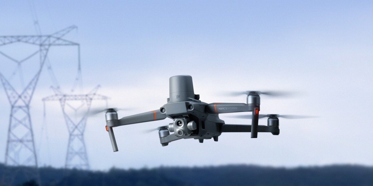
Drones have revolutionized the way topographical surveys are conducted. These unmanned aerial vehicles (UAVs) can quickly cover large areas that would take days or weeks to survey manually. Here’s how drones enhance topographical surveys:
- Increased Accuracy: Drones can capture high-resolution images from above, providing accurate and detailed data points that were previously hard to obtain with traditional ground surveying tools.
- Speed and Efficiency: Using drones, surveys that would typically take weeks can now be completed in a matter of hours. This saves time, which is critical in the early stages of project planning.
- Access to Difficult Terrain: Drones can easily access areas that are difficult or dangerous for humans to survey, such as steep hills, rivers, or remote locations.
How Combining Drone Technology with Survey Tools Maximizes Efficiency?
To maximize the benefits of drone surveys, it's essential to combine drone technology with the right surveying tools. Here are some ways this combination leads to better project efficiency:
Photogrammetry Software
Photogrammetry is a technique that uses photographs to create maps and models of a given area. When combined with drone technology, photogrammetry software can analyze the images captured by drones and generate detailed 3D maps or models of the terrain. This is especially useful for projects that require a high level of precision, such as road construction or land development.
By using photogrammetry software, professionals can quickly process the data collected by drones, reducing the time required to create topographical maps. These digital models can be shared with teams in real-time, enabling faster decision-making and project adjustments.
LiDAR Technology
LiDAR (Light Detection and Ranging) is another powerful tool that, when combined with drones, provides even more accurate topographical data. LiDAR uses laser beams to measure distances, creating highly precise elevation models. This is particularly useful for projects that require fine detail, such as forest management, power line inspection, and flood risk assessment.
LiDAR technology allows professionals to create 3D topographical models with millimeter precision. Combining it with drones enhances its reach, enabling surveys in areas with dense vegetation or challenging terrain that would be difficult to measure using traditional methods.
Geographic Information System (GIS) Integration
Geographic Information Systems (GIS) play a crucial role in managing and analyzing topographical survey data. By integrating drone data with GIS software, surveyors can overlay various data sets, such as land use patterns, infrastructure, and environmental data, onto the topographical maps. This creates a comprehensive view of the project area, allowing for more effective planning and decision-making.
Combining GIS with drone data enhances the ability to analyze geographical features over time. For example, surveyors can compare historical data with current surveys to assess changes in the environment, enabling more informed planning for future development.
Benefits of Combining Drone Technology and Tools
The integration of drone technology with tools like photogrammetry software, LiDAR, and GIS offers several significant advantages for project efficiency:
- Faster Project Timelines: Drones can capture large areas quickly, reducing the overall time needed for surveys and allowing for faster project initiation.
- Cost Savings: By reducing the time and labor required for surveys, the use of drones and modern tools helps lower project costs.
- Improved Data Accuracy: The precision of tools like LiDAR and photogrammetry provides more accurate topographical data, resulting in better planning and fewer errors during project execution.
- Increased Safety: Drones can access areas that may be hazardous for humans, reducing the risk of accidents during the survey process.
Conclusion
Incorporating drone technology with advanced surveying tools is a game-changer for topographical surveys. The combination not only increases project efficiency by reducing time and costs but also provides more accurate data for informed decision-making. For industries ranging from construction to environmental management, the use of drones and modern tools is paving the way for smarter, faster, and more effective project execution.